Фортеця Харків: Лопанські ворота

Озвучено за допомогою ШІ (Google Cloud).
Текст перекладу
Kharkiv Fortress: The Lopan Gate
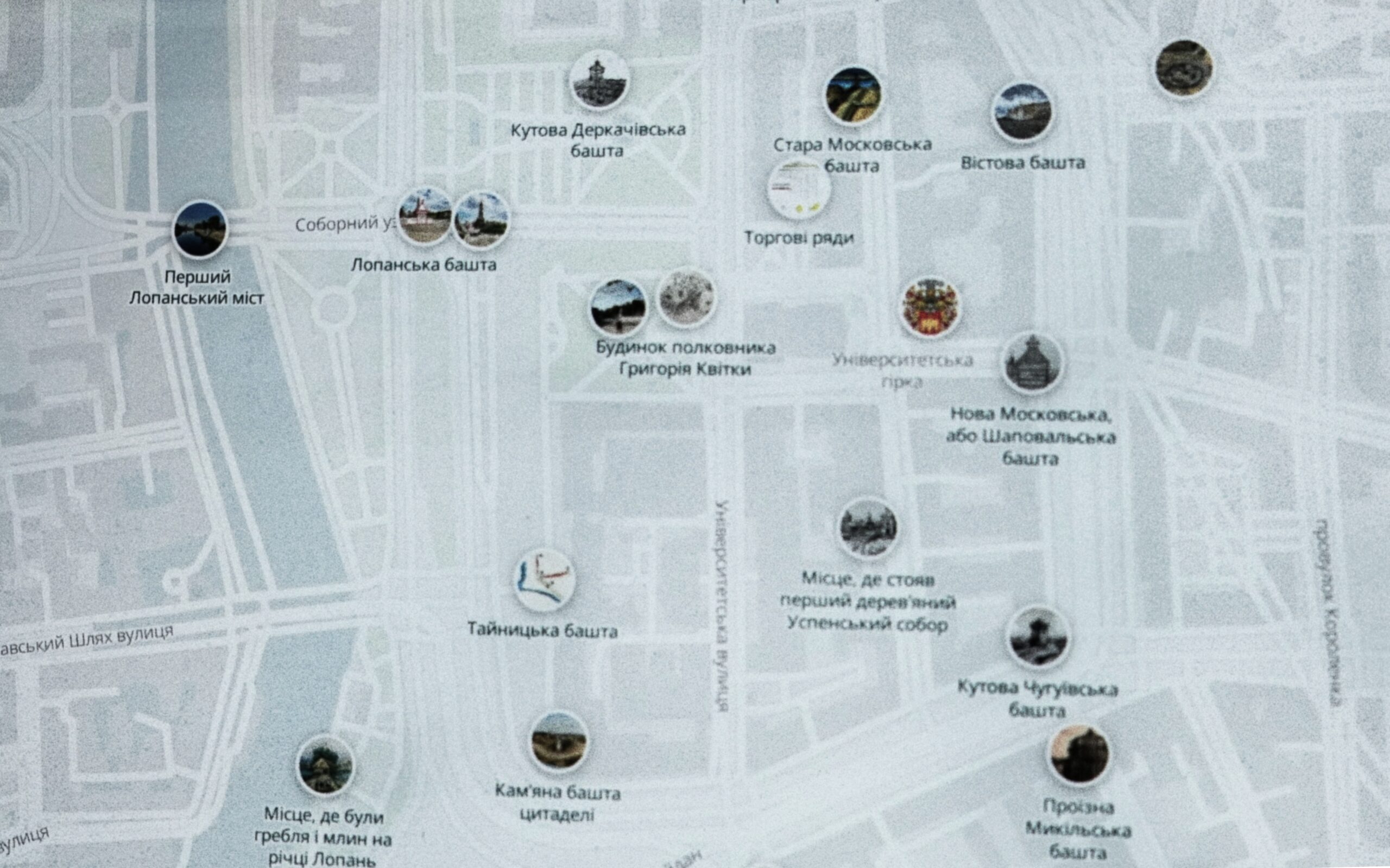
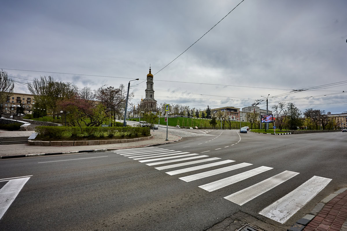
Back in the early 2000s, I found myself puzzled by the layout of the modern intersection of Klochkivska Street, Soborny Uzviz (Cathedral Descent), and Sergiyivska Square. Initially, I assumed this peculiar zigzag was the result of World War II street fighting, which had destroyed the historical trading rows on Sergiyivska Square. Later, I speculated that the boundaries of the nearby monastery garden had shaped it.
I had no idea that its origins traced back to the days of the Kharkiv Fortress. Even on the famous 1970s reconstruction map by architect Volodymyr Novgorodov, the fortress walls were depicted running along the crest of the hillfort (horodyshche). In 2009, my colleague Oleksandr Pariysky and I mapped them the exact same way on our physical model of the Kharkiv Fortress.
It was only after I obtained scanned copies of the city plans from 1709, 1720, 1730, and 1742 that I discovered the western section of the fortress walls had a completely different configuration in the early 18th century. Archival sources revealed that the steep terrain prevented the garrison from constructing standard walls and towers here, unlike the northern, eastern, and southern sides of the Kharkiv hillfort.
Long before the fortress was built, a road connecting Belgorod to the Mozhesky outpost (modern-day Valky) ran directly through the Kharkiv hillfort. It descended from what is now Universytetska Hill, followed the path of modern Soborny Uzviz, and made a sharp left turn. Near the site of the modern Lopan Bridge, there was a natural shallow area that allowed travelers to ford the Lopan River and continue their journey on the right bank.
However, the construction of the fortress and the daily activities of its inhabitants soon changed everything. The river began to shift, showing its unpredictable temper. Forading it became nearly impossible during the spring floods and heavy autumn rains. Building a permanent bridge over the Lopan became a necessity. Naturally, they decided to construct it directly opposite the road descending the hill — where modern Soborny Uzviz lies.
In the 17th and 18th centuries, this descent was a ravine with rather steep slopes. Contemporary historical documents refer to it as a "strait" or a watercourse, as it served as a natural drainage channel for rainwater rushing down from the Kharkiv hillfort. The fact that the road to the Mozhesky outpost ran through this ravine points to its seasonal nature, as it would have been entirely impassable in early spring or late autumn.
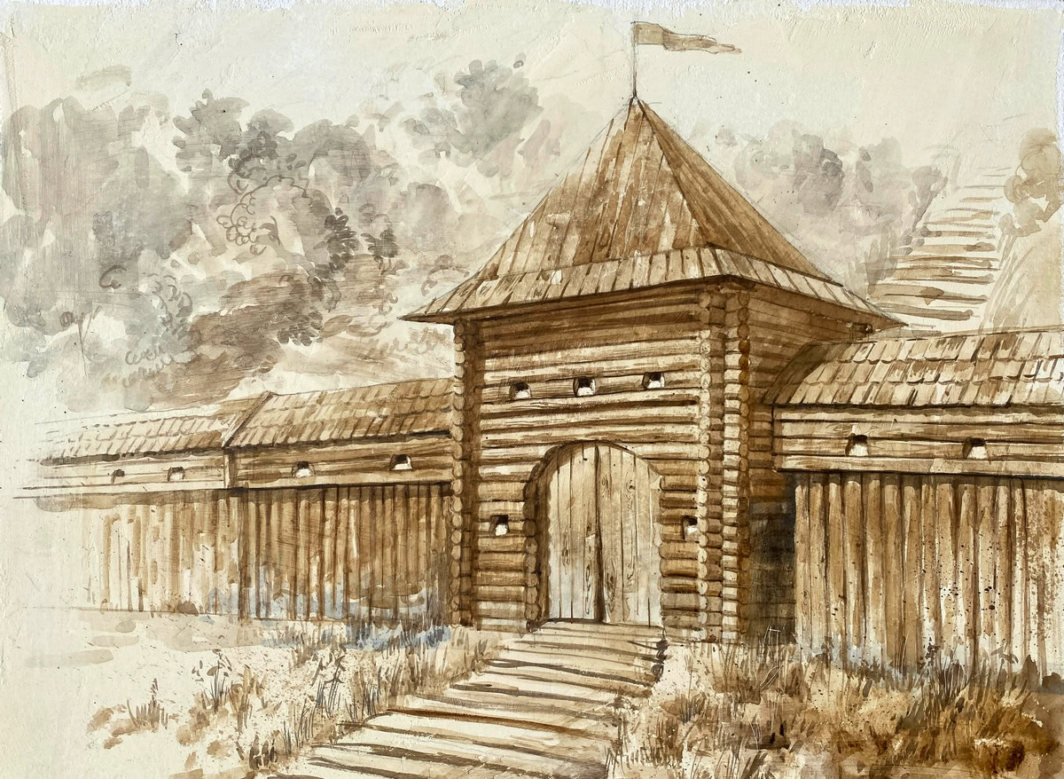
In 1656, during the construction of the initial fortress, this ravine was blocked by wooden palisade (ostroh) walls, with a basic gate installed in the center. In 1658, as the main towers of the Kharkiv Fortress were being erected, the garrison attempted to replace the gate with the wooden Lopan Gate-Tower (Lopanska proizna bashta). However, in the spring of 1659, torrents of meltwater swept away the unfinished structure.
This disaster forced the garrison to lay a heavy timber deck over the ravine, directing the water torrents underneath it. Instead of a massive tower, they built a new, fortified gate. It was a square structure with walls measuring 1.4 fathoms (about 3.2 meters) wide and 2 fathoms (4.26 meters) high, topped with a hipped roof. It was directly opposite this gate that the very first Lopan Bridge was constructed.
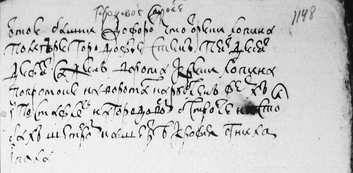
The Lopan Gate stood until the early 18th century. Its gradual decay is meticulously documented in the garrison's annual "estimate" (smetnye) books. The entries note: "The roof on the hipped structure has rotted" in 1667; "The roof on the hipped structure has rotted and collapsed" in 1669, and so it continues until 1701.
The construction of the New Town (Novyi Horod) fortifications began between 1695 and 1698 during the Azov campaigns, under the local governor (voivode) Semyon Durnovo. This new outer fort surrounded Kharkiv from the east, north, and west. By 1700, the defensive lines were still incomplete, with a gap of about 300 fathoms (around 639 meters) left entirely unprotected. These walls and towers were finalized only after the tsarist governor-led administration was abolished.
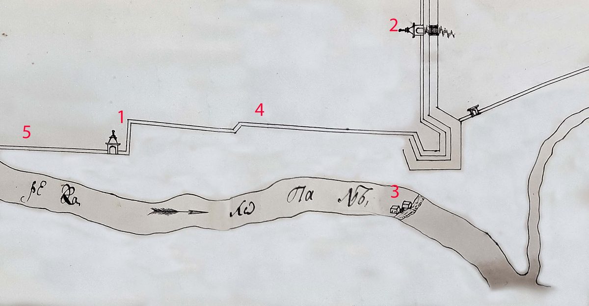
By 1708, a full-fledged, fortified Lopan Gate-Tower stood in place of the old gate. It was pushed significantly forward toward the riverbank — about 20 fathoms (42 meters) from the original gate site. It was at this precise moment in history that the distinctive road zigzag, which we still see today when transitioning from Sergiyivska Square onto Klochkivska Street, was formed.
This new Lopan Gate-Tower first appeared on the city plan of 1709, drawn during Tsar Peter I’s visit to Kharkiv. It appeared again on a map drawn in the spring of 1730 by Captain Matthias Retsch. This 1730 map reveals that instead of a solid wall, only temporary fortifications connected the right side of the tower to the upper citadel. Later that year, following recommendations by Major General Peter de Brigny, a permanent moat was dug, an earthen rampart was raised, and the tower was reinforced with a small corner wall. The older walls near the dismantled original Lopan Gate remained in place.
The subsequent plan of Kharkiv, dated 1742, was compiled after the catastrophic fire of May 1733. It indicates that while all the inner walls and towers of the central citadel had burned to the ground, the outer fortress walls of the New Town along modern Klochkivska Street, including the Lopan Gate-Tower, survived. Finally, a 1767 plan of the citadel maps the topography of the area where the Lopan Tower and the outer walls once stood. The Lopan Gate-Tower remained standing until at least 1756, after which it and the adjacent defensive walls were dismantled.
A new bridge over the Lopan was eventually built further downstream, and the road running through the old ravine lost its strategic purpose. None of the late 18th or early 19th-century city plans included it as a viable thoroughfare. It wasn't until after 1833 that the City Improvement Commission decided to redevelop the area, driven by the relocation of the market from the Zakharkivska neighborhood across the river to Blahovishchenska Square, and the construction of the new Kupetsky (Merchants') Bridge.
A road called Kupetsky Lane was paved along the old ravine bed, appearing on the city plan of 1846. Sometime later, it was renamed Sergiyevsky Lane in honor of the former Governor-General Sergei Kokoshkin. However, after 1879, the lane was downgraded to a minor driveway but regained its historic name: Kupetsky. Apparently, the city decided that having Sergiyivska Square named after Kokoshkin was more than enough.
Following the death of the prominent merchant Vasyl Pashchenko-Tryapkin in 1894, his massive estates were bequeathed to the city, and Kupetsky Driveway was renamed in his honor. Yet, on the 1916 map of Kharkiv, it appears once again as Kupetsky — though classified as a descent (uzviz) rather than a driveway. In the early Soviet era, it briefly retained the name Kupetsky Uzviz until a 1932 map marked it as Khalturinsky. During World War II, the German occupation administration reverted it to its historical name (Kupetsky). Finally, in 2009, Khalturinsky Uzviz was officially renamed Soborny (Cathedral) Uzviz.
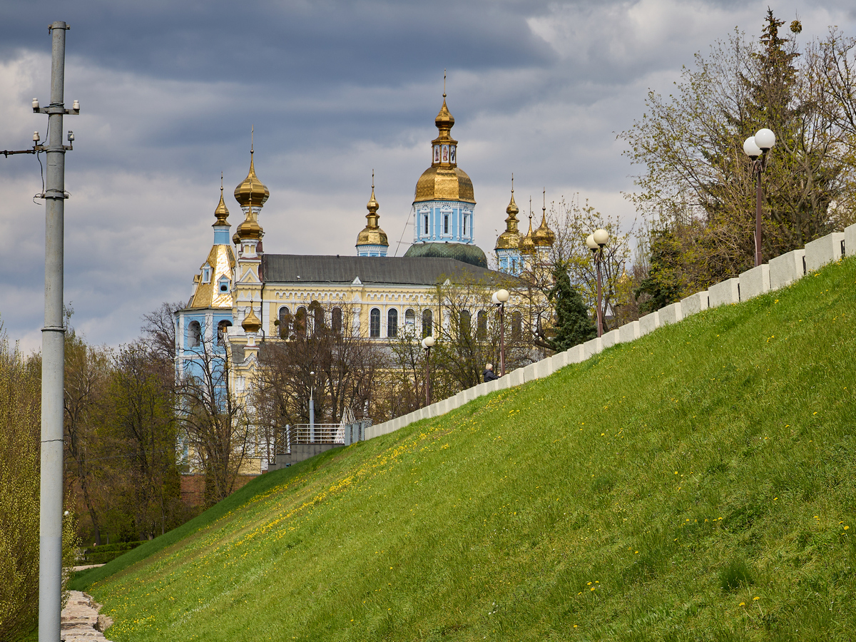
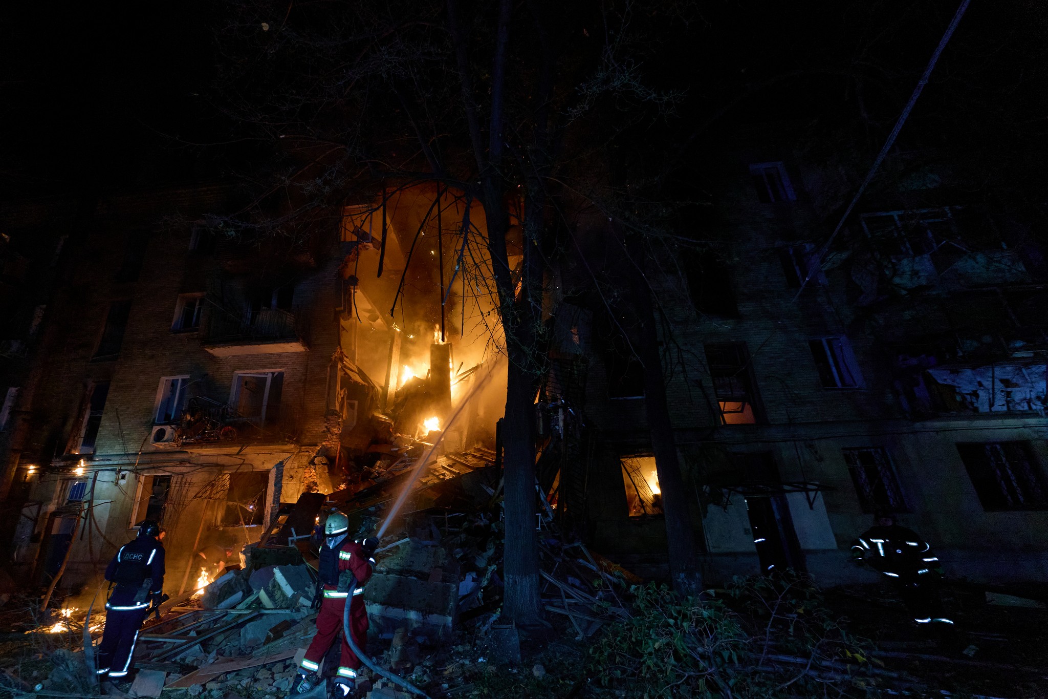
The area to the left of the old Lopan Tower (where Pokrovsky Square sits today) was purchased in 1766 by merchant Artem Karpov. As he developed houses, wings, and retail arcades, he began leveling and flattening the steep slopes of the ancient ravine. In the second half of the 19th century, this expansive property was acquired by the aforementioned Vasyl Pashchenko-Tryapkin, who constructed the famous pre-revolutionary shopping center known as the "Passage." The buildings of the Passage were severely damaged during intense street fighting in March 1943 and were never restored after World War II. In their place, the Terrace Square was created, known today as Pokrovsky Square.
To the right of the old Lopan Tower, an open-air market of the same name began to take shape after 1765. It proved highly difficult to organize, consisting mostly of fish stalls and crude wooden benches for small-scale vendors. A devastating fire in 1835 put an end to the Lopan Bazaar. Brick trading rows were built in its place, and in 1861, the former market square was officially named Sergiyivska Square, also in honor of Kokoshkin. In 1932, the Soviet regime renamed it Proletarska Square, but in 2016, its historical name was restored: Sergiyivska Square.
Today, the unusual zigzag connecting Sergiyivska Square, Klochkivska Street, and Soborny Uzviz serves as a physical, living memorial to the layout of the ancient Kharkiv Fortress.
“Kharkiv Fortress” is a historical series by Andriy Paramonov, a prominent researcher of the history of Sloboda Ukraine. Read the author’s full column on MediaPort.
Ще на початку 2000-х років мене почало дивувати сучасне перехрестя Клочківської вулиці, Соборного узвозу та Сергіївської площі. Спочатку я вважав, що цей дивний зиґзаґ сформувався після того, як під час Другої світової війни внаслідок вуличних боїв були знищені торгові ряди на Сергіївській площі. Пізніше я думав, що на його формування вплинула територія монастирського саду. Я і гадки не мав, що все тягнеться з часів Харківської фортеці, хоча на відомій реконструкції 1970-х років архітектора Володимира Новгородова фортечні стіни проходили поверх городища.
Ще у 2009 році ми з колегою Олександром Парійським так і розміщували їх на макеті Харківської фортеці. І лише після того, як я отримав скановані копії планів міста 1709, 1720, 1730 та 1742 років, я дізнався, що на початку XVIII століття фортечні стіни західної ділянки мали іншу конфігурацію. Завдяки архівним джерелам стало зрозуміло, що рельєф місцевості не дозволяв гарнізону зробити тут стіни і башту, як це було на півночі, сході та півдні Харківського городища.
Ще до будівництва фортеці через Харківське городище проходила дорога з Бєлгорода на Можеський острог (Валки). Вона спускалася із сучасної Університетської гірки, йшла Соборним узвозом, повертала наліво, де неподалік сучасного Лопанського мосту існувала мілина, що дозволяла перейти вбрід на правий берег Лопані, де дорога продовжувалася. Але спочатку будівництво фортеці, а потім життєдіяльність її жителів внесли свої корективи. Річка почала змінюватися і проявляти характер. До того ж перейти її вбрід навесні під час розливу та восени під час паводку було важко. Тож побудова мосту через Лопань стала необхідністю.
Звісно, його вирішили будувати навпроти місця, з якого йшла дорога, тобто сучасного Соборного узвозу. У XVII-XVIII століттях то був ярок із доволі крутими схилами. У тогочасних джерелах його називають протоком, оскільки ним стікала вода з Харківського городища. Те, що ним йшла дорога на Можеський острог, скоріш за все, теж свідчить про сезонність її використання, оскільки ранньою весною чи пізньою осінню пройти там було неможливо. У 1656 році, під час будівництва першої фортеці, протік перекрили острожними стінами, а посередині поставили звичайні ворота.
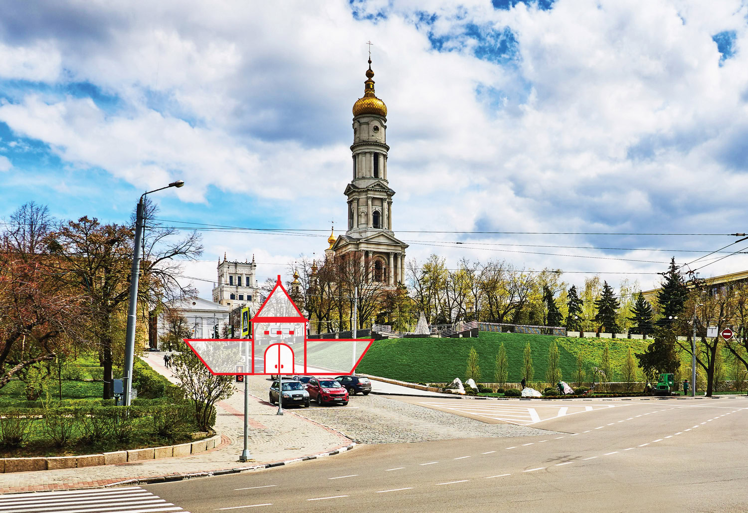
У 1658 році, коли були зведені головні башти Харківської фортеці, на протоці замість воріт почали ставити Лопанську проїзну башту, але навесні 1659 року її, ще недобудовану, знесли потоки води. Це змусило гарнізон зробити на протоці настил із дерев’яних колод, направивши потоки води під ним. Замість башти були побудовані нові ворота, які являли собою у формі квадрат із довжиною стін 1,4 сажні (близько 3,2 м). Вишина воріт сягала 2 сажнів (4,26 м), а завершував їх шатровий дах. Саме навпроти цих воріт і був зведений перший Лопанський міст.
Лопанські ворота проіснували до початку XVIII століття. Вони показані в «сметных» книгах. У 1667 році в них йдеться, що «На шетре кровля огнила», у 1669 році — що «На шетре кровля огнила и опала», і так далі — до 1701 року.
Будівництво укріплень Нового міста було розпочато в 1695-1698 роках, під час Азовських походів, коли харківським воєводою був стольник Семен Дурново. Новий форштадт фортеці оточував Харків зі сходу, півночі та заходу, на 1700 рік кріпосні стіни ще не були закінчені повністю. Близько 300 сажнів (близько 639 м) завдовжки не були перекриті навіть острожними стінами. Ці стіни та башти були добудовані вже після скасування воєводського управління.
Між тим, на 1708 рік замість Лопанських воріт вже стоїть повноцінна Лопанська проїзна башта, яка була доволі далеко винесена в бік річки, до 20 сажнів (близько 42 м) від попереднього місця розташування воріт. Саме тоді і сформувався зиґзаґ, який зберігся дотепер, при переході від Сергіївської площі у Клочківську.
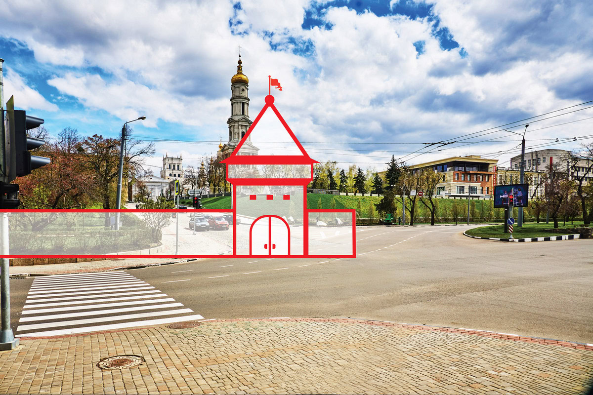
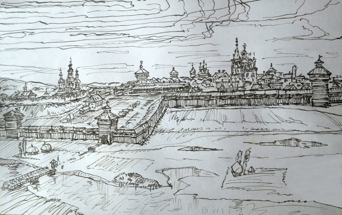
Вперше нова Лопанська проїзна башта була позначена на плані 1709 року, складеному під час перебування у Харкові московського царя Петра Олексійовича. Вдруге вона позначена на карті, складеній навесні 1730 року капітаном Матіасом Ретчем. На цій карті можна побачити, що замість повноцінної стіни праворуч від башти до стіни цитаделі наверху тягнуться лише тимчасові укріплення.
Наприкінці того ж року за рекомендацією генерал-майора Петра де Бриньї замість тимчасових укріплень були викопані рів і насипаний вал, а сама башта отримала праворуч невелику кутову городову стіну. Стіни поруч із розібраними колишніми Лопанськими воротами залишилися на своєму місці.
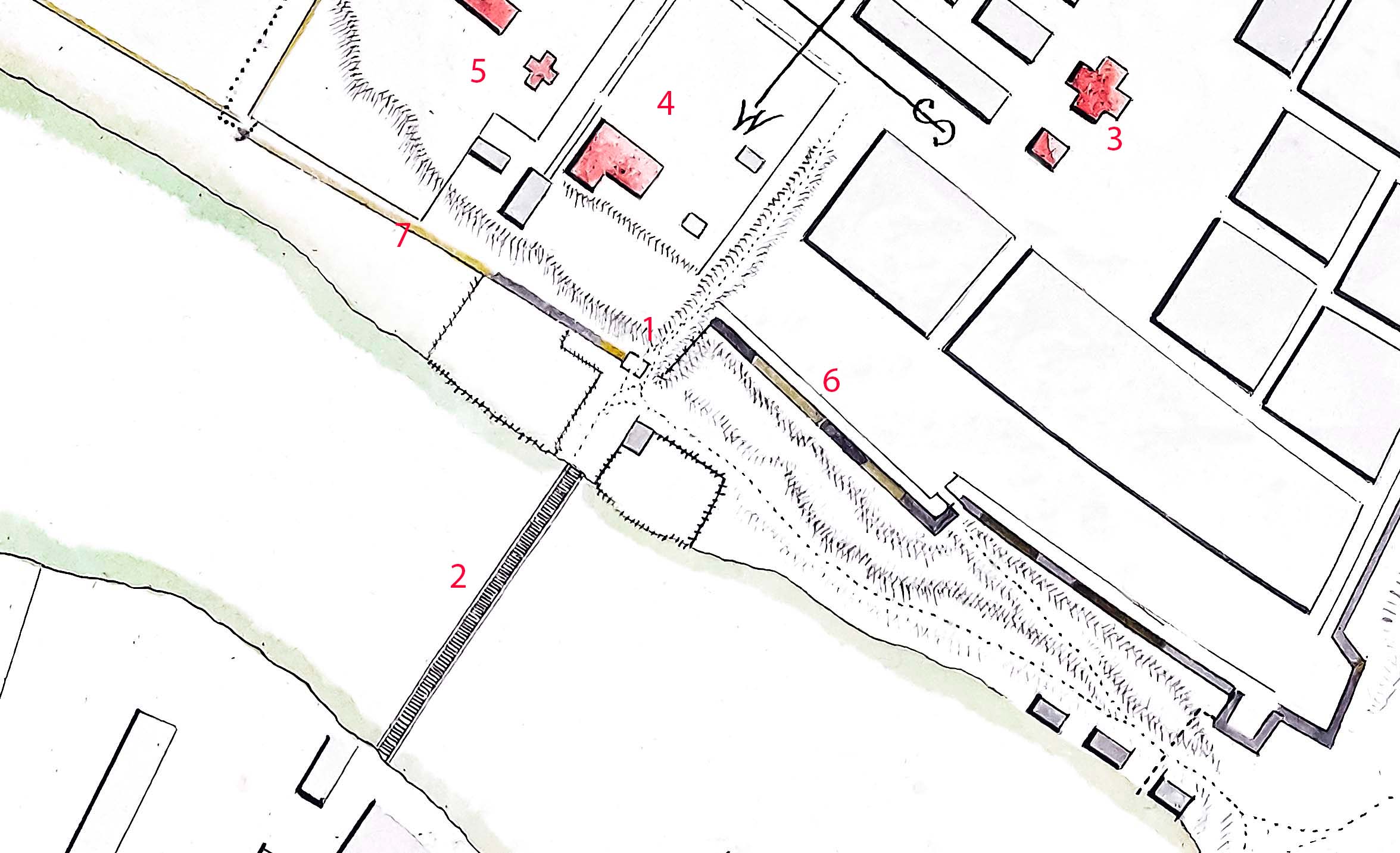
Наступний план Харкова — від 1742 року, тобто складений вже після великої травневої пожежі 1733-го. Він свідчить, що хоча в середині цитаделі всі стіни і башти вигоріли, але фортечні стіни Нового міста вздовж сучасної Клочківської, як і Лопанська проїзна башта, залишилися.
Нарешті на плані цитаделі 1767 року показано рельєф місцевості, де колись стояли Лопанська башта і фортечні стіни Нового міста.
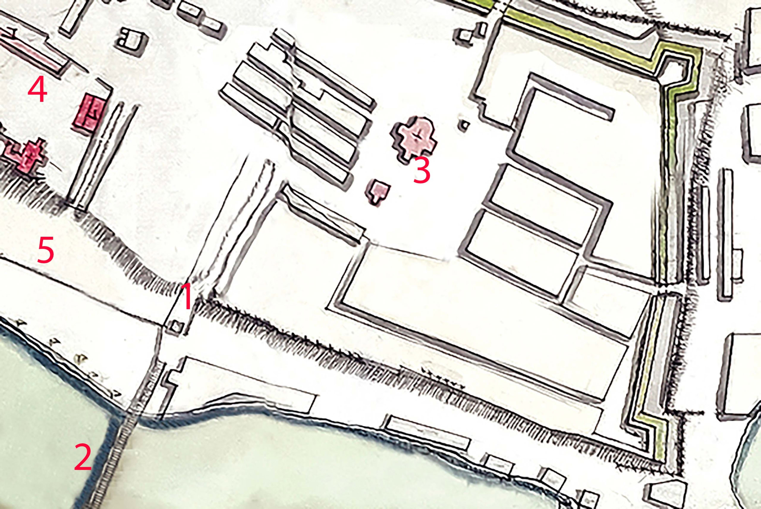
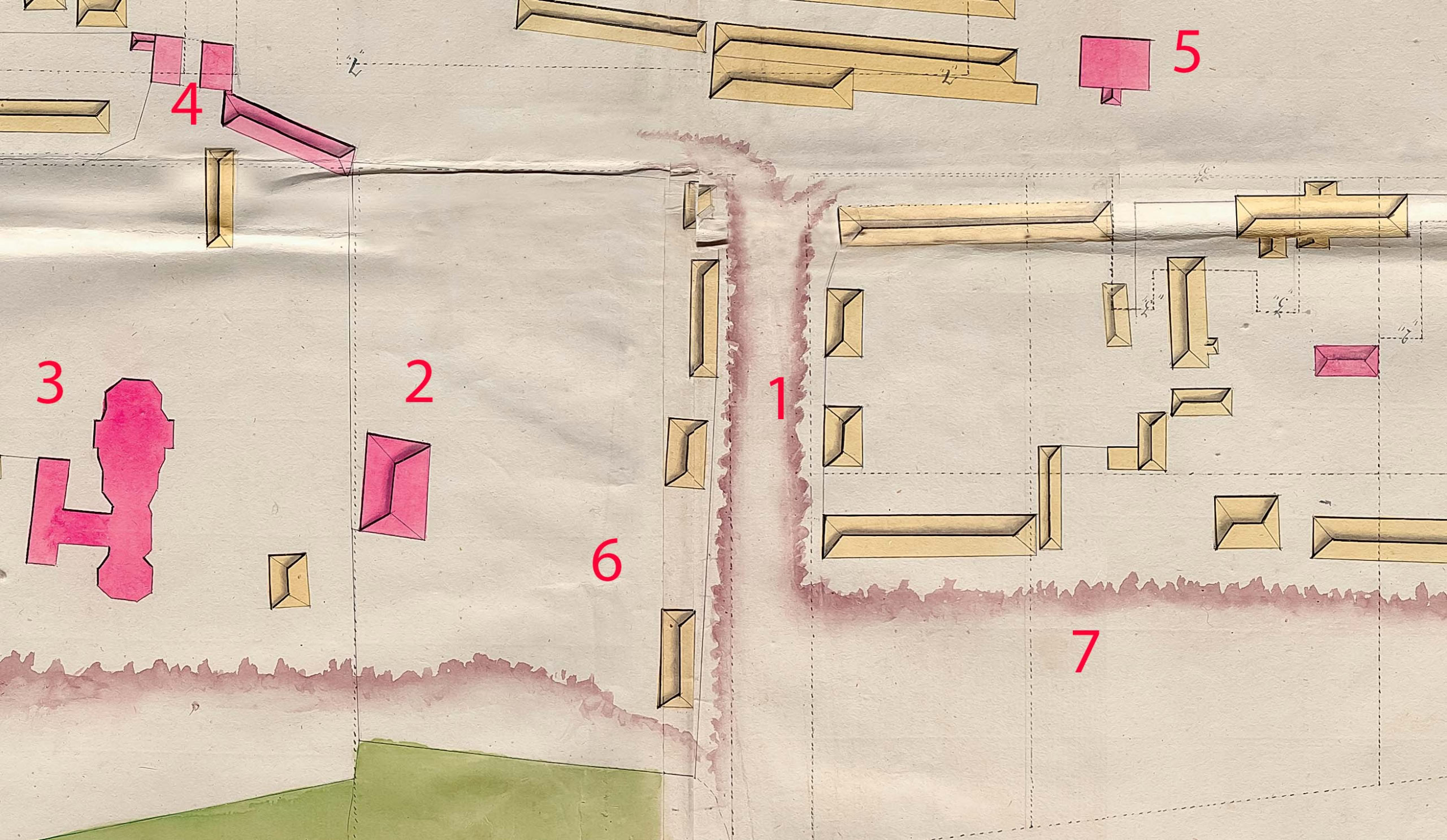
Лопанська проїзна башта існувала щонайменше до 1756 року, а потім вона і фортечні стіни поруч були розібрані. Новий міст через Лопань було побудовано нижче, і потреба в дорозі по протоку відпала. Жодний перспективний план міста кінця XVIII — початку XIX століть не враховував його як можливу дорогу. Тільки після 1833 року Комісія з благоустрою вирішила дати йому ладу, тим більше, що базар із Захарківської слободи був перенесений за Лопань, на Благовіщенську площу, а через річку побудували Купецький міст.
По протоку проклали Купецький провулок, що показаний на плані 1846 року. За деякий час його перейменували на Сергіївський (на честь колишнього генерал-губернатор Сергія Олександровича Кокошкіна). Але після 1879 року провулок зменшили до проїзду, проте повернули стару назву — Купецький (мабуть, вирішили, що Кокошкіну вистачить Сергіївської площі). Після смерті у 1894 році купця Василя Пащенка-Тряпкіна всі його величезні маєтності були подаровані місту, і Купецький проїзд перейменували на його честь. Проте на плані Харкова 1916 року він знову показаний як Купецький, щоправда, не проїзд, а узвіз. На початку радянських часів він залишався Купецьким узвозом, але недовго. На плані 1932 року він позначений як Халтуринський. Під час Другої світової війни німці повернули йому стару назву (Купецький). А з 2009 року Халтуринський узвіз став Соборним.
Місцевість ліворуч від Лопанської башти (де зараз Покровський сквер) викупив у 1766 році купець Артем Карпов. Під час будівництва будинків, флігелів та торгових рядів він почав зривати частину колишнього ярку. У другій половині XIX століття це велике дворове місце викупив вже згадуваний купець Василь Пащенко-Тряпкін, який звів відомий всім ще в дореволюційні часи торговельний центр «Пасаж». Будівлі «Пасажу» постраждали під час вуличних боїв у березні 1943 року. Відновлювати їх після закінчення Другої світової війни не стали. Так на тому місці з’явився Терасний сквер (нині — Покровський).
Праворуч від Лопанської башти після 1765 року почав формуватися одноіменний базар, доволі складний в упорядкуванні. Окрім базару, тут існували рибні ряди й дерев’яні лавки для дрібної торгівлі. Пожежа 1835 року припинила існування Лопанського базару. Замість нього були побудовані кам’яні торгові ряди, а колишня базарна площа у 1861 році стала Сергіївською, на честь того ж Кокошкіна. У 1932 році її перейменували на Пролетарську, а у 2016 році — повернули первісну назву: Сергіївська площа.
Сьогодні зиґзаґ між Сергіївською площею, Клочківською вулицею та Соборним узвозом є одним із меморіальних місць колишньої Харківської фортеці.
«Фортеця Харків» — цикл матеріалів дослідника історії Слобідської України Андрія Парамонова. Читайте колонку автора на MediaPort